All About the Town’s Trails

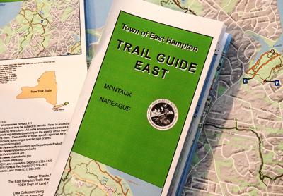
Two new, full-size maps depicting some 213 miles of trails within the Town of East Hampton are now available, after a comprehensive effort across several town departments that included trudging along just about every inch of the trails, through woodlands and meadows, cliffside and shore.
The maps, one covering trails from Wainscott through Amagansett and the other Napeague to Montauk, are on sale at the town clerk’s office for $10 each, or both for $15. They show the various town preserves, provide information about named trails as well as old woods roads and paved roads, and mark for hikers the locations of scenic views, cemeteries and other gravesites, historic sites, and the scattered glacial erratic rocks that recall the area’s geologic past. They also provide contact information for all the landowners and entities involved in preserving East Hampton’s open space, from the county and state to town agencies, the East Hampton Trails Preservation Society, and the Peconic Land Trust.
But while comprehensive and useful, the maps themselves represent only the tip of a data iceberg — a massive amount of information compiled over the last several years and collected in a database held by the town, which, after a bit more effort and time, will become open to and searchable by the public.
“It’s not just a paper map that has lines on it,” Bob Masin, who oversaw the recent mapping, said yesterday.
For each of the trails depicted on the maps, there is a wealth of collected information: its route, terrain it traverses, blazes used to mark it, mileage, points of interest along the way, and so on.
A geographic information system overseen by the town’s information technology department has been quietly gaining depth and breadth, thanks largely to the efforts of Barnaby Friedman, a G.I.S. technician, and Mr. Masin, a G.I.S. supervisor. Beginning about a decade ago, the technology experts have been creating “layers” of information, Mr. Masin said this week, inputting information maintained by the town as well as data provided by the state and private entities.
The information can be sorted according to numerous criteria, and the I.T. department uses it to create custom maps for other town departments — zoning and land-use maps, for instance, or, for the aquaculture department, maps showing the bay locations of shellfish growth areas, both past and present.
The G.I.S. system can link to another database used by the town, adding access to “tabular data,” Mr. Masin said, such as the property records kept by the town assessors or the building department.
Over the last few years, Mr. Masin has spent countless hours in the field, walking the trails with a G.P.S. device to collect accurate information for the maps. Andy Drake and Andy Gaites of the town’s land management department, whose work regularly takes them to preserves all around the town, joined the effort later and “accelerated the process.”
Information on the trails maps is up-to-the-minute, and the system is designed so that changes, such as trails being rerouted or new items of note, can be easily incorporated as new maps are printed. When the next phase is completed, Mr. Masin said, the public, using a mobile app, can access the maps, print their own if they like, and read through some of the extensive information that has been collected.
“It’s a lot of moving parts that you have to line up, get connected,” he said.
