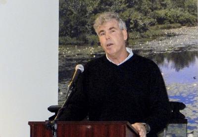
Coastal Retreat Called Only Option

Coastal retreat, however politically unpopular it may be, is the only logical response to sea level rise, an environmental advocate told an audience at the South Fork Natural History Museum in Bridgehampton on Saturday.
Kevin McAllister of Defend H2O, formerly the Peconic Baykeeper, said that municipalities, the federal government, and the Army Corps of Engineers are making the wrong choices based on political and cost considerations rather than the long-term, science-based planning that would allow resilience.
The intertidal zone — where the marine system meets terra firma — is characterized by dynamic equilibrium, a system that will remain in balance or adjust based on the supply of sand, the shape of the beach, energy, and sea level rise, Mr. McAllister said. “If something is changing, there will be a modification on one or all sides of that equation,” he said.
But as illustrated in slides depicting coastlines on Long Island as well as in the Carolinas and Florida, the consequences of hard structures such as jetties, groins, and geotextile tubes are more harmful than effective, he said. He called such efforts, along with the elevation of structures and roadways, both expensive and shortsighted.
“If we’re not looking at it in a holistic manner — a large system — we’re short-selling the dynamics and the continuity of sand flow,” he said of efforts to protect a particular section of shoreline. “You almost have to keep connecting the dots, if you will, with structures, because of the impacts of the initial structure that is causing downdrift. We’ve seen this time and time again.”
On Montauk’s north coast, the beach on the eastern side of the inlet is accreting, he said, while the harbor’s jetties block the natural migration of sand westward. As a result, “you have property owner after property owner trying to stabilize the shoreline for protection of their homes” west of the jetties, “all the way to Culloden Point.”
He questioned the wisdom, for example, of the Army Corps of Engineers plan to dredge the inlet, deposit the sediment on the “sand starved” beach, and construct a groin field intended to lock in the deposited sand. “We’re talking a lake environment, so the sediment is different,” he said of the inlet. Depositing that sand on a “high-energy ocean-style beach,” such as that abutting Block Island Sound, “the material will not match up. It will be finer, under wave attack will disappear very quickly, and then we’re left with groins, more structures out there.”
The appropriate approach, he argued, is sand bypassing, or recouping the material on the eastern, updrift side and moving it to the west. “They don’t want to spend the money to do it,” he said. To the Army Corps, “this is just another job, and then cut and run. You have to invest in the proper approach, in this case sand bypassing, which would require annual maintenance, and moving material through, to have some semblance of stability on this downdrift side.”
Where revetments or geotextile tubes are installed under the sand, the roots of beach grass that naturally run deep and stabilize a dune system cannot perform that function. “These plants never fully mature, never do what they do best,” he said.
At Mastic Beach, which, like downtown Montauk, is at low elevation, “you can see the wetlands migrating, tidal marshes moving landward in conjunction with sea level rise,” Mr. McAllister said. Where the Army Corps wants to elevate houses and roadways, “what we have going on with sea level rise is inundation, groundwater coming up vertically. . . . As much as we may be controlling surge and storms, you’re not changing anything with regard to flooding.” A better approach, he said, would be to “buy out the homes, as opposed to foolish structural remedies that will have no bearing on reality.”
Pointing to Dune Road in Quogue, Mr. McAllister cited a prevalence of “sunny day flooding” due to coastal inundation. “With respect to certain areas where we have developed” — including Lazy Point in Amagansett — “because of their low-lying elevations, they’re going to be susceptible to sea level rise.”
With a scientific consensus that New York State’s coast will experience a sea level rise of between 16 and 36 inches by the 2050s, he said, these low-lying areas are in peril. “Elected officials do not want to hear me, but because we have minimal development in this strand of Dune Road, I think we need to have retreat from this area, and not continue with big investments.” Over the long term, “it’s a losing prospect to think that we can define that fluid line, the dynamic edge, and say we’re going to stay there forever.”
That includes downtown Montauk, he said. “We have to find the political will to . . . buy out those 10 or 12 seasonal hotels, extinguish the structures there, and bring in a high volume of native beach sand. If it means dredging offshore and beach nourishing in the interim to restore functions and values of the natural system, that’s where we need to go. That will provide greater protection to the downtown while we’re figuring out where we need to go with the downtown,” which, he said, “will become an isthmus at some point. These are hard choices.”
