Nature Notes: An Island in 2200

Every winter it seems, we have one or two northeasters, but rarely does one come accompanied by both a blizzard and full moon tides. Such was the case over the weekend and we were still digging out on Monday. Some meteorologists are saying that we could have another storm, almost equally as strong, this coming weekend.
Sandy, in the last days of October 2012, was both a hurricane and northeaster. It also hit when flood tides were on the move and many local roads were underwater for a few hours. Police barred traffic across Long Beach Road in Noyac, for example.
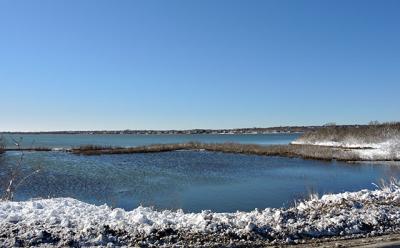
One body of water that tends to overflow its banks when the easterly winds push the water up into the Peconic Estuary coincident with a full moon tide is Lake Montauk, which is connected to Block Island Sound by an inlet first dug in the middle 1920s when Montauk saw the beginning of a major changeover just before to the financial crash of 1929. The lake has remained open and groined on both sides ever since. What used to be the biggest freshwater body on Long Island is now a midsized harbor.
When Lake Montauk fills to the brim, it tends to run south under the Montauk State Parkway, as the late Stuart Vorphal, a Montauk watcher for many years, was wont to observe. Normally, the water flows north from the manmade pond behind the dune at Ditch Plain to the lake via the Oceanside dreen. Such a phenomenon, which only occurs once or twice in a decade, will become the norm when sea level rises another foot or so.
The lake has a very big watershed to draw runoff from. On the west the Montauk Downs golf course and the land surrounding it runs off to the lake. On the east, the top of Startop is the dividing line; west of it, water runs westerly, crossing over or under East Lake Drive on its way to the lake. On the south, water from half of Shadmoor and Ditch Plain all the way to the Montauk Association houses along the eastern bluffs runs north into the lake.
Four small streams run into the lake: Peter’s Run on the west, Oceanside dreen on the south, Osborne Creek on the southeast, and the stream from Big Reed Pond on the northeast. In addition, Stepping Stones Pond lets out to the lake on the southwest, along with two small ponds on the south, as well as Little Reed Pond on the east. The latter stream is brackish, as the pond from which it stems is semi-tidal. In the past, alewives ran up to Big Reed Pond and Stepping Stones Pond to breed, but these days culverts block their passage and it is a rare event when an alewife makes it up to breed in either water body. On the other hand elver eels have no problem navigating the culverts and still inhabit both ponds.
During the flood tide events of Saturday and Sunday, Little Reed Pond, which is normally a mere puddle, was full to the brim all the way to its eastern terminus, while Stepping Stones and Big Reed pond, normally 100 percent fresh, may both have received a shot or two of saltwater.
The coastal bluffs of Montauk west of the downtown area take a beating during such storms. They are composed of glacial till, peat, boulders, and clays, and when the bluff faces approach verticality because of toe erosion, sloughing from the top and middle increase. Blobs of vegetation — bayberry, goldenrod, phragmites, and the like — slide down the slope, some all the way to the beach below.
The very large boulders, glacial erratics, roll down in a tumbling gait and settle at the bottom. Those enormous ones you see part of when you stand in front of the bluffs and look out to the water — manned by striper fishermen during the fall striper run — washed out of the bluff centuries ago. Once they hit bottom they don’t budge and become more and more submerged as sea level rises slowly around them.
Fifty years or so ago, the bluffs eroded back much more slowly than they do in the new millennium. For a long time one foot of loss a year was the norm. As hurricanes, tropical storms and northeasters have increased in frequency since 1984, the pace of erosion has quickened such that some spots, for example Cavett’s Cove, are losing four or five feet a year. While they recede, little ponds such as the ones in front of the Cavett house, and houses to the east, as well as ones just east of the Montauk Shores Condominiums in Ditch Plain, drop into the ocean. While Cavett’s used to contain cranberries, sedges, and golden hyssop, it has become a field of goldenrods in the past 9 or 10 years, but dig down to the goldenrod roots and you will find pond sediments consisting of clay and silt.
Some say Montauk is doomed as sea level rises and the frequency and intensity of coastal storms increases. Hither Hills and the highlands east of the lake have a long future ahead of them, but it’s only a matter of time, say a few hundred years, before the Atlantic sea level reaches Fort Pond and Lake Montauk from the south. By then Napeague to the west, Montauk’s escape route, will also be underwater. Anybody want to buy an island in the Atlantic for a few bits of wampum in a 2200?
Larry Penny can be reached via email at [email protected].
