Nature Notes: A Man Ahead of His Time

Nature Notes: A Man Ahead of His Time

By
Larry Penny

    Nowadays, we hardly listen to our elders. Everybody wants to fast-track to the top, and young people speak a different language than us senior citizens. Everything is “cool,” but is it really? Before there was a host of school and post-school activities to attend and try to be good at, life was simple. It wasn’t easy, but it was simple. You worked hard and got along.

    There were a few wise individuals who would be called prophets in the Biblical past; they proselytized to the rest of the community and tried to keep the train from leaving the track.

    Every community had a couple of them. East Hampton was particularly rich in self-made sages, but in the early and middle 1900s, one stood out above the rest. He was a man of the earth who grew up in Springs. He fished and farmed while managing to also get an education. He was one of two boys in his senior class prior to graduation.

    His first 17 years were idyllic. He had the kind of boyhood that many don’t experience. When he wasn’t working, he wandered. He observed nature, fished, crabbed, clammed, hunted, and read widely. Most of all he was a very sagacious observer. And what he saw, he remembered. Much of it he wrote down, the way an old-time whaling captain meticulously recorded each day’s activities in the ship log.

    When you’re a boy and exploring, every little nook and cranny is worth investigating. Thus was Ferris Talmage’s penchant for seeking out this and that. Springs was mostly farmland and woodlands. Cattle grazed the meadowlands surrounding Accabonac Harbor and waterfowl were common. Ferris knew every little spot of interest in Springs and in one of his writings, “The Springs, In the Old Days: The History of a Long Island Village,” he wrote every one of them down. Many have since disappeared — they were either built on, filled in, or paved over. Notwithstanding the fact that I spent 28 years working for the Town of East Hampton, many of these places were new to me or, at least, the old Bonac names were new to me.

    Who today knows of Bellyache Swamp, Willow Hill? Molly’s Hill, where Stephen Talkhouse came into being? Shadom, Gunk Hole, Green Spot, Little Low Drink, Squaw Cove, Sage Island, Great Meadow, James’s Spring, Plato’s Island, Old Slough? There are many more. Ferris knew them all intimately.

    Farming became his primary trade. He grew just about everything and he knew soils. One might say that it was by dint of his day-to-day communing with the farmland and forest lands that he became a soil conservationist, then blossomed into an all-encompassing conservationist. By the mid-1950s he was already espousing the wonders of the local soils, the loams deposited by the forces of glaciation and the loess deposited by the the winds. In a day when the agricultural colleges were pushing artificial fertililizers, in the same way they pushed DDT and other powerful, but very toxic post-World War II pesticides, Ferris stuck to the old ways. Indeed, he first began farming when menhaden were still being used as fertilizer, not to mention the leavings of livestock and chickens.

    He once proclaimed that it takes at least 100 years to make good soil, and in the same breath, bemoaned the new practice of artificial fertilization and pesticide applications, thinking that good soils would be degraded in a very short time by such practices. His words and actions were prophetic. His predictions of 60 years ago ring true today. The surface waters lining the shores of Long Island are overly rich in nitrogen. Brown, red, and purple tides are coloring waters that were once blue.

    Stuart Vorpahl, in my eyes, almost as wise and prophetic as Mr. Talmage, was one of Ferris’s students upon leaving the Coast Guard. He remembers the days when he was still a young man and when he sat in Ferris’s living room and listened and shared what he had to say.

    Later in life and even after he lost his vision, Ferris became more and more active. In the days before just about everybody was becoming an ecologist, Ferris was an environmentalist of the old school. It’s a pity that so few East Hamptoners took advantage of the knowledge he so generously shared; we’d be much better off today if we had.

    Luckily, some of his wisdom did rub off, however. East Hampton, when compared to towns in western Suffolk County and Nassau County and many localities across the country and throughout world, is in pretty good shape. Not everyone has become a lawyer or deals in real estate. There are still fishermen and farmers working the waters and the soils. I’m optimistic. You have to be, don’t you?

There’s Action Close to Shore

There’s Action Close to Shore

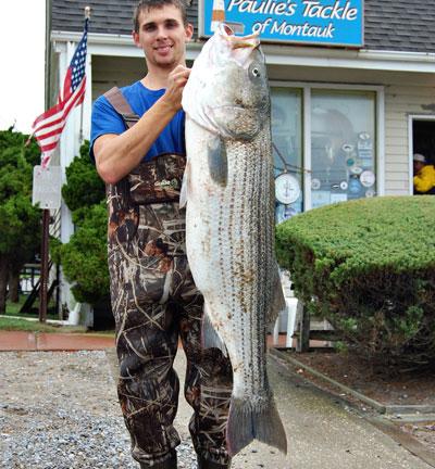
Robert Van Velsor caught this 42.46-pound striped bass “by accident,” from Ditch Plain beach in Montauk on Friday. The big striper took a bucktail in knee-deep water.
Mark Foschi
With high winds and heavy surf, the action stayed close to shore over the weekend
By
Russell Drumm

   “It’s Montauk,” was how Sue Jappell at Paulie’s Tackle shop in Montauk explained what happened to Robert Van Velsor on Friday.

    Van Velsor was heaving a bucktail toward the horizon while standing in knee-deep water at Ditch Plain beach. He was at the end of a retrieve and was in the process of lifting the lure out of the water when a 42.46-pound striped bass snatched it. That’s the way to do it.

    With high winds and heavy surf, the action stayed close to shore over the weekend. Casters worked two and three-ounce bucktails with some success on bass and big bluefish feeding on snappers and a mix of other prey in the whitewater of collapsing waves.

    On Sunday afternoon, a quick study of the fish coming off the Venture and Adios charter boats in Montauk Harbor revealed two large bass for every angler (the state bag limit) and monster, pot-bellied bluefish in the 15 to 18-pound range.

    The potbellies were testament to the mass of prey species that continue to surround Montauk Point despite recent heavy seas. On Monday, Chris Miller of the West Lake Marina said the bassing had slowed, but it’s important to remember Ms. Jappell’s “it’s Montauk” maxim. October fishing is phenomenal by most fishing standards.

    Miller did rave about the black sea bass action at places like Cartright Shoal, Southwest Ledge, and the West Grounds. They cannot resist clam and squid baits. Nor can voracious schools of porgies.

    Ken Rafferty, a light-tackle and fly guide, made the distinction between the productivity of the larger sport-fishing boats and the mosquito fleet of fly fisherman. Despite their ability to weather heavier sea conditions, charter boats are having success trolling wire line. “I can’t fish like that,” Rafferty said. Dragging wire is a style of fishing anathema to light-tackle aficionados. Rafferty said he’d heard that the fishing in New York Harbor was “lighting up,” a sure sign that the striped bass migration was moving south and west. 

    There has been a change on the leader board in the Montauk SurfMasters tournament. Gary Aprea has knocked Atilla Ozturk out of third place with a 22.7-pound bass caught on Monday. Gary Krist and Klever Oleas hold on to first and second places with 29.15 and 26-pound stripers. John Bruno’s 40.3-pounder is the sole leader in the contest’s wetsuit division.

    Christine Schnell, Mary Ellen Kane, and Cheryl Lackner have 18.8, 14, and 11.8-pound bass in the women’s contest. Dylan Lackner leads the youth division with a 13.5-pound bass, and Brian Damm is still the top kid with a 14.6-pound striped bass.

Nature Notes: Many Names, Same Bowl

Nature Notes: Many Names, Same Bowl

Once we had rain, we had runoff
By
Larry Penny

   They say 70 percent of the earth’s surface is water. Astronomers and astrophysicists have conjectured that it comes primarily from comets (frozen water and dust) that struck the earth. One large comet carries a big cargo. If we were one of the cold planets, all this water would be ice. In a hotter climate, it would boil away and the atmosphere would be too hot and humid to sustain life, at least not human life.

    Very early on, the nature of this water was tied to the comets that provided it. In all likelihood it was fairly uniform in composition and quite fresh. Until the water cycle started up, most of the water just sat there, perhaps, whipped by the winds, and evaporated into the newly forming atmosphere. It wasn’t until the atmosphere became supersaturated with water vapor here and there and droplets formed around condensation particles that there was such a thing as rain.

    Once we had rain, we had runoff. The classical Greeks, without understanding what we call gravity, postulated that water seeks its own level. Runoff ran from high areas — the land — to low areas — the seas and lakes. Runoff not only fills depressions with water, on its way it erodes hard surfaces, like rocks, and that begins the process of soil making.

    The aqueous slurry running downhill also dissolves minerals like salts from rocks and carries those salts to the seas. The seas, once fresh, become saltier and saltier. Without rain, we wouldn’t have rivers, erosion, and the salty oceans.

    With all that runoff, why didn’t sea level get higher and higher and higher? The water cycle put as much water back into the atmosphere as it dumped on land and on the surface of the seas. An equilibrium of sorts kept sea level on an even keel during Earth’s early years. It wasn’t until the earth entered into long-term cooling and warming periods that sea level began to fluctuate.

    Glaciation lowered sea level; glacial melting caused it to rise. We are in the latter phase at this moment in space and time, and sea level is rising.

    Earth’s surface waters are either saline, fresh, or brackish. Seawater is contained in various natural compartments, the largest, of course, being the oceans, the so-called “seven seas.” The next largest are gulfs and seas, such as the Gulf of Mexico and the Mediterranean Sea, followed by bays and sounds, like Hudson Bay and Puget Sound. Then come straits, coves, harbors, inlets, tidal creeks, and so on. Long Island has all of them with the exception of straits. Plum Gut running between Orient Point and Plum Island is not large enough to be called a strait. Canals are artificial straits or guts and the biggest are filled with running seawater.

    Oceanography and marine biology are the study of the oceans, while limnology is the study of freshwaters. The latter rank in size from the largest, the Great Lakes, down to the smallest, ponds and holes. Perhaps, because freshwater bodies, with the exception of a few like the Hudson River, are non-tidal and are not interconnected, they have more local names than saltwater bodies. Those that are not quiescent and run always downhill have many, many names — rivers, streams, brooks, rills, rivulets, kills, creeks, runs, sloughs, dreens, swales, and the like.

    Long Island has a few permanent rivers. The Peconic, Nissequogue, and Cannetquot are the largest. They differ from most upstate rivers in that they are more dependent on groundwater than runoff for their flows. The Peconic River is the largest groundwater-fed river in New York State. On the South Fork we have several streams that have different local names — Peter’s Run in Montauk, Tan Bark Creek or Soak Hides Dreen at the south end of Three Mile Harbor, Ely Brook or Alewife Brook in Northwest, Sebonac Creek in North Sea, Ligonee Brook in Sag Harbor, to name but a few.

    Some of these freshwater streams, such as the one that runs south along the east side of Stephen Hand’s Path thence into Georgica Pond in Wainscott, run into bodies of water that are brackish, such as Georgica Pond, or Mill Creek in Water Mill, which feeds Mecox Bay, or the stream from Jeremy’s Hole in Sagg Swamp in Bridgehampton, which runs into Sagaponack Pond.

    Almost all of the standing freshwater bodies on the South Fork are called ponds, while the smaller ones are called “holes,” — Barnes Hole, Wolfie’s Hole, and Wolf Swamp, Daniel’s Hole, Chatfield’s Hole, etc. It has been conjectured that Short’s Pond, or Scuttlehole Pond, north of Scuttle Hole Road in Bridgehampton, was named after a kettle hole left by the retreating ice sheet. In Mattituck on the North Fork, one of these holes is called Wolf Pit. A few of the ponds have more pretentious names, such as Lake Agawam in Southampton Village. Lake Montauk has been tidal since the mid-1920s, but it was once the largest freshwater pond on Long Island.

    Around the world there are a bunch of names for those runoff channels carved out by millenniums of erosion, the intermittent streams that are dry longer than they are wet. In the American West there are arroyos, gulches, swales, sloughs, and such. The larger ones are called canyons. In the Near East and Middle East they are wadis, as in Irrawady.

    There are also artesian freshwaters called springs or seeps that rise from the water table. The shore at the edge of Springy Banks running along the west side of Three Mile Harbor is famous for its seeps. Pussy’s Pond in Springs is fed by the springs that the hamlet is named after. That venerable Bridgehampton centenarian farmer, historian, and celebrated weatherman, Richard Hendrickson, once explained to me how he can find a spring coming up in a tidal cove or tidal creek. You walk around with bare feet until you feel the bottom get cold. Groundwater in the summer is generally 15 to 20 degrees colder than the tidal water into which it seeps.

    In the old days these water bodies and wet spots were only protected by humans out of respect and a sense of good stewardship. In much of the world, including almost all of the United States, water bodies are protected by law.

    Water, we couldn’t live without it, and neither could the millions and millions of different animals and plants with which we cohabit. We all drink from the same bowl.


Nature Notes: Pre-Storm Activity

Nature Notes: Pre-Storm Activity

This one is giving us a real scare
By
Larry Penny

   It’s Monday afternoon. This could be the Big One of which I spoke earlier. It’s  pounding Noyac, and the best is yet to come. Noyac Bay is washing across Long Beach Road and marrying Sag Harbor Cove, it’s like the old days, before Suffolk County constructed Long Beach Road. Connecting Noyac with North Haven. I’ve been in this Noyac house since 1979 and have only seen those two water bodies meet up once before.

    The upper half of a scarlet oak trunk, nearly two feet in diameter, just came crashing down on the roof, shaking the entire house, knocking stuff off  kitchen shelves, breaking chinaware, and the like. I went out to look and it looked like Tyrannosaurus rex was stretched out the length of the roof. It wasn’t one of the large dead limbs that my wife has been after me to deal with for years. It was the live trunk with lots of live branches and lots of leaves. It must have offered more resistance to the gale force winds streaming in from the northeast than the leafless dead ones. I thought about getting the chain saw out and removing it right on the spot, but then another limb came down, and I decided to go inside and wait for the storm to run its course.

    A week ago when this monster was slowly churning through the tropical Atlantic, the weather modelers predicted that after hitting Jamaica and Cuba it would begin turning to the northeast and head out to sea. Then, on Thursday, the predictions had it heading up the coast.  And, now, here it is, at our very doorstep. Since we are on the east side of the eye we are going to be hit with some of the strongest winds and highest flood tides. I can’t wait until 9:30 or so tonight to see how really high it gets. It might crest at Montauk at a record level, one not seen since the 1938 Long Island Express.

    This time around the forecasters got it right. It’s another Perfect Storm, maybe even stronger than the Halloween storm 21 years ago.  This one is giving us a real scare. I was in the top of the Montauk Lighthouse looking out the windows with Walter Galcik when that one hit. We looked down at the waves hitting the revetment repair, which Greg Donahue finished just in the nick of time. In fact, Greg was still down there clambering around the giant rocks in a rain slicker dodging the waves and checking out the line of rocks to see how they were holding up. Then he came up to us in the turret, dripping wet, but with a smile on his face.

    This year, Greg and his team, and Patrick Bistrian Jr., repaired the revetment in the spring, long before the advent of the second Perfect Storm. Will it hold up? You can bet that at this moment Greg is down there checking it out. A storm like this can tear up everything in its path and change the sea bottom landscape as well as the shape of the shore for hundreds of miles.

    On Friday, when news of the impending storm was buzzing around our heads, Vicki Bustamante and I were looking for a couple of state endangered species at Culloden, one of which grows in the angle between the toe of the bluff and the back shore of Block Island Sound. By luck, we went before the storm hit and after walking a mile or two over stone and sea wrack we came to several plants of that very vulnerable species, Scotch lovage. A few were still flowering, but most were going to seed, and just in time too. Scotch lovage seed can tolerate seawater the way sea poppy seeds can. Hopefully, they will be picked up by the storm, then drift around in the water and waves and eventually come to rest somewhere else along the South Fork’s north shore to start a new colony.

    We also spooked a two-foot long eastern ribbon snake, a graceful slender thing that slithered away from us over the forest floor as fast as we could walk. We finally caught up with it and snapped its picture. We surmised that the snake was getting ready to hibernate; they usually go under before November. Or maybe it was sensing the impending storm the way several other kinds of animals as monkeys and parrots seem to do innately.

    Strangely, on the following day, Vicki and her son Chris were motoring along East Lake Drive and they came upon two more ribbon snakes crossing the road toward Lake Montauk. They stop­ped the car and shooed them off. Good thing they did, because up the road they came across two more that weren’t so lucky; they’d been run over. Chris rescued an inch-long baby snapping turtle having a tough go of it crossing Big Reed Path the day before. Just hatched out?

    The odd spate of pre-storm ribbon snake activity begs the question. What about all of the birds around now, the waterfowl, the sparrows, the gulls, a few lingering cormorants, the wild turkeys, do they sense the advance of hurricanes and northeasters and act appropriately, i.e., take cover? Drive around during a big storm such as this one and you’re lucky to see a single bird. Apparently, they don’t need to tune into the Weather Channel or listen to Andrew Cuomo, Governor Christie, or Mayor Bloomberg to know what to do. They just do the right thing!

Master of the Mistress Too

Master of the Mistress Too

Capt. Fritz Hubner, a Montauk fishing legend, celebrated his 80th birthday recently and said he has no plans to retire from the water.
Russell Drumm
The veteran charter captain recently turned 80
By
Russell Drumm

   Capt. Fritz Hubner of Montauk said that before superstorm Sandy arrived he hauled the Captain Jay, the fishing boat he’s been running for the past 14 years. Experience has proved the better-safe-than-sorry adage many times over, he said in a recent interview.

    The veteran charter captain who recently turned 80 said he had planned to hang it up 14 years ago, but a private boat owner liked his fishing experience and offered him the helm of his 43-foot Viking, the Captain Jay; he has been skippering ever since. 

    He was working for an UpIsland Cadillac dealership at the age of 23 when he began venturing to Montauk to go surfcasting with addicted locals like Grant Adams and Percy Heath. “Fishing’s better now. We never caught that many fish in the 40s back then. Most of us had beach buggies.”

    Hubner’s first foothold in Montauk was a trailer at the Ditch Plain trailer park, the starting point for many a fisherman, and gentrified since into the Montauk Shores Condominiums. His first boat was a 19-foot outboard he called the Shudda, as in “you shudda been there.”

    Hubner entered the charter industry at the age of 40, when he made the permanent move to Montauk. His first job — to support his fishing — was with Skip Reichart at what is now the Diamond Cove Marina.

    Why did he name all his charter boats the Mistress Too, you might ask? Simple, he said: He was not married to his significant other at the time, therefore, his boat was his mistress, also.

    The first was a 30-foot, lapstrake Chris-Craft followed by a second 30-footer, also wooden. Then he bought a 38-foot Eldridge McGuinness from Capt. Ralph Pitts, wood-over-glass, then a 38-foot Brownell, and finally, an all-glass (“less work”) Hatterass 41, the Mistress Too he ran for 12 years with a loyal mate, Rob Knapp, and a loyal clientele before going private. “I just got tired of getting up at 5 a.m.” Hubner’s fellow charter captains recently feted him at the Harvest restaurant on occasion of his 80th.

    “No,” he said, the charter business is not what it once was, what with ever-more-restrictive regulations, and the influx of part-time charter captains, “half-fishermen,” he called them, “retired firemen and lawyers. I don’t know how these guys pay their mortgages.” And no, he has no plans to retire from the water.

    Capt. Lou Rosado has shared Montauk waters with Fritz Hubner for the past 55 years. He reported Tuesday that the “black fishing is as good as it gets,” with one fish over 13 pounds caught over by Fisher’s Island. And, there has been good striped bass fishing since the storm. However, “there’s a lot of rips that ain’t there,” he said, the bottom carved and whittled by Sandy’s forceful currents. “They’re not as high as they were. What you know for the last 25 years, forget about it.”

    Paulie’s Tackle shop in Montauk also reports some surfcasting action along the north side of Montauk Point.

Nature Notes: The Shoreline After Sandy

Nature Notes: The Shoreline After Sandy

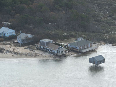
These Lazy Point vacation houses, already exposed by erosion, were left in a far more precarious position by Hurricane Sandy.
By
Larry Penny

   We’ve been through one helluva storm and one not quite helluva. The Oct. 29 storm in many ways rivaled the hurricane of 1938, which almost wiped out eastern Long Island and much of New England. After the cleanup, the rebuilding and the getting back to normal here on the South Fork, we go about our day-to-day activities, thankful that the Big One is gone and things could be worse.

    What about the impacts of such whopper storms on the flora and fauna of land and sea and the ecotone that is the seashore between the two? What about the impact on the geology, what geologists call coastal morphology, the shape of the coast? It would seem that such a visitation with 70-mile-per-hour winds, crashing waves 20 feet high, and flood tides 12 feet high churning and about for a 24-hour period would create some major changes, both in the short run and years after.

    It goes without saying that the shoreline suffered and was changed throughout, not only along the entire Long Island-Staten Island-New Jersey shore. It will take a lot of thinking and a lot of action to put the coastline back in reasonable shape. Maybe the storm’s leaving and more than a week of suffering and doing without by hundreds of thousands of residents will finally move the Army Corps of Engineers to finish the Fire Island to Montauk Point study that has been going on for almost 40 years now at a cost of many, many millions of taxpayers dollars. Something might come of it after all, otherwise it will turn out to be just another colossal waste of money that big government is famous for.

    The seashore taken collectively around all of the world’s oceans is the largest biome that we have, other than the oceans themselves. Measured end to end and between subtidal to supratidal boundaries, the world’s seashore is much larger in area than all of the deserts, or deciduous forests, or coniferous forests, or prairies. It’s a valuable habitat for at least 100,000 plants and animals that are extremely rare, such as the federally endangered seabeach amaranth and federally threatened piping plover, both of which are found on Long Island beaches and shores.

    Much of the coastal strand vegetation has been wiped out in a single blow. Fortunately, the seeds of much of it remain viable after tumbling around in the water and many will come to rest above the high tide line and renew the near continuous swathe of sand-loving plants that reaches along the south and north coasts of the Island. That swathe, and the sea wrack, and other detritus that washes up into it, is the embryo of future dune development. It provides a little fence that catches the sand and starts building a ridge of sand parallel to the water line that can ultimately grow into a full-fledged dune when conditions are right.

    Unlike the dunes, the coastal bluffs of Montauk and Long Island Sound as well as the smaller ones of Shelter Island, Gardiner’s Island, and other spots along the Peconic Estuary’s shoreline don’t grow back. They erode one storm at a time and that’s that. The Montauk ones are particularly susceptible to erosion as they take the biggest waves of all. As they erode back, the unique strip of bluff-top habitat is lost, often permanently. The state-endangered orchid Arethusa and several other rarities grow and flower along on that narrow strip behind the face of the Montauk bluffs stretching from the Lighthouse to the western boundary of Shadmoor State Park.

    But we know very little about the longer-term impacts of an extraordinary long-duration, low-pressure system that drives and lifts up the water several feet above the norm while dramatically resculpting the bottom. What comes to mind immediately is the brown tide that so decimated the Peconic system in 1985. While a causal relationship has yet to be determined, it happened a year after a very large March 1984 northeaster that changed the shoreline and bottomlands of much of the Peconics, loosening up caches of organic nitrogen and other pollutants to waft in the water column. In September of 1985, Hurricane Gloria hit us spot on and again the shoreline and bottomlands were rewritten. The brown tide persisted until nearly the end of the 1980s, the eelgrass throughout much of the bay’s waters and their tributaries disappeared, and the scallop population dropped to nearly zero.

    But, by the same token, such meteoric storms may have a positive rather than a negative impact. Take the back-to-back storms of 1991 that hit us. They opened up a new channel between the ocean and west Shinnecock Bay, locally named Pike’s Inlet. Such an opening was followed by a favorable change in water quality and there was a huge set of hard clams and a regrowth of eelgrass. The current hard clam doldrums in the Great South Bay — once the number one producer of Mercenaria mercenaria in the United States — may just be attributable to the absence of such an overriding storm. Come next year, we will see, won’t we?

    When I was a mere tween in Mattituck on the north side of the Peconics in 1946, my father came home from work one September afternoon and said, “The scallops are back in the bay at New Suffolk.” The next day we were there with our crab nets and our hands catching them. They had been gone from much of the north side of the estuary for years and years. Oddly, there was a no-name hurricane that came along in September of 1944. It beat up Long Island Sound and the Peconics badly. Keeping in mind that the bay scallop has an average life cycle of two years, could the re-emergence of the bay scallop population two years later have had something to do with that storm?

    Except for the cost in human terms, it may be that not all large coastal storm systems are bad in all respects. It’s conceivable that a rebirth triggered by one can help put shellfish on the table for the next generation. We’ll have to keep a sharp eye out.

Nature Notes: Global Warming?

Nature Notes: Global Warming?

New species of Canada goose in town
By
Larry Penny

   Live and learn, no matter how old. Reading Angus Wilson’s latest local bird-sighting blog, I just learned that there is a new species of Canada goose in town and it’s actually been here for a pretty long time, but it’s new to the East End in a couple of ways. Firstly, it was separated from Branta canadensis in 2004 by the American Ornithological Union and given its own scientific name, Branta hutchinsii, or Richardson’s cackling goose. The new one, which apparently has been around for millennia, but not here, is smaller, has a shorter bill and is divided into several subspecies based on size, color, and where it breeds. According to Angus, the one seen on Sunday among typical Canada geese in a Montauk field was one of the subspecies, hutchinsii.

    Another thing I learned was that the typical Canada geese, which we have so many of during the winter and quite a few during the breeding season, as well, isn’t native as a breeder on Long Island, nor in the rest of the state. It was introduced to breed during the Great Depression years in a few Long Island spots. Canada geese can mate for life and so it stands to reason that once a pair bred here successfully, the original mom and pop would come back again and again. Don’t blame what some perceive as a Long Island goose problem on Mother Nature, but on the old Conservation Department and some other abetting entities.

    There are a couple of specimens of Richardson’s cackling goose housed in the American Museum of Natural History, taken in Montauk and elsewhere on Long Island, one from Sayre’s Pond in Southampton on Nov. 20, 1968, as reported in the late John Bull’s “Birds of New York State.”

    But the cackling goose sighting was topped by a bird more rare, one not from the Americas but from Eurasia — the northern lapwing. A pair was spotted in the Deep Hollow Ranch field in Montauk on Saturday morning by Jorn Ake and immediately reported to Angus Wilson, who got the word out immediately. Birders from points far and wide flocked to the scene, but by the time most got there, the pair had flown the coop. Not to give up so easily, searchers spread out. One of them, Peter Polshek, checked the Montauk Airport field and there they were. The next day they were back at Deep Hollow Ranch and beheld by a slew of enthusiasts who had missed out on the first go around.

    The lapwing that showed up in a Bridgehampton field north of Mecox Bay in 1995, hung around for weeks and weeks. A friend of mine who went several times to see it, not only observed it but recorded mentally several of the license plates of the many witnesses. There were some from California and other points more than 1,000 miles away. That lapwing generated a great amount of interest, as these two have already.

    Marge Winski, the Lighthouse keeper who survived the Big One in the lighthouse as it shook and rumbled, went outside once or twice to see how high the water was. On one such foray, a brown pelican flew by. A week later a live brown pelican was found tangled in a fishing net off Dune Road in Westhampton and taken to the Wildlife Refuge Center of the Hamptons. It is apparently recovering and its leg band is being checked to find out its origin.

    I was awoken on Sunday morning by some splashing outside my bedroom window where I keep my mosquitofish during the summer. The drops of water spattering on the windowpane were coming from a yellow-breasted chat, the largest of the wood warblers and an unusual bird to be seen at this time of year. It was vigorously washing itself.

    Another rare bird reported over the weekend in the Angus blog was the Brewer’s blackbird, found by Michael McBrien at Rita’s horse farm in Montauk. This is a western species with a pugnacious nature during the breeding season that I am all too familiar with. Several used to dive at me from perches in sidewalk trees as I made my way back and forth to the San Francisco State University campus on 19th Avenue in the early 1960s.

    These are just a few of Mr. Wilson’s reportings. Vicki Bustamante and her son Chris keep coming across ribbon snakes doing this and that in Montauk, notwithstanding the severity of the storm and the afterstorm. It’s awfully late for snakes to be about, but, then, isn’t the earth’s temperature rising? Barbara, who works at Pat Bistrian Jr.’s place on Springs-Fireplace Road in East Hampton and lives not to far away from the office, has been keeping track of chipmunks in her yard for several years and knows each one, even though to the average eye all chipmunks look the same. She reported that her chipmunks had disappeared before the storm, but as of last week at least one was up and active.

    It emerged from hibernation earlier than usual, on Feb. 11, the day that Whitney Houston died, and it is apparently going to hibernate later than usual, I guess. It appears as if the local chipmunks’ hibernations, which used to be long siestas, are becoming short naps. Could it be global warming? It’s very possible.

Nature Notes: Montauk Could Be an Island

Nature Notes: Montauk Could Be an Island

The tide is coming in
By
Larry Penny

   The scientists tell us that sea level is rising. The tide is coming in. In point of fact, sea level has been rising since about 12,000 years ago when the last ice age came to end. In some coastal areas it has risen a couple hundred feet, so sea-level rise is nothing new in the same way that volcanoes, hurricanes, tornados, earthquakes, and tidal waves are nothing new. It is only that those others were fast-acting, while sea-level rise is a creeper.

    In fact there are places along the edge of the world’s oceans where the sea level is falling. It’s all relative. The continental masses rest on plates, which float on a molten rock fluid, at least that’s our best guess. When you add weight to a particular plate, it is depressed and the water level edging it rises in relation to the plates sinking. Glaciers are exceedingly heavy. They press down on the particular plate on which they sit, accompanied by an adjacent sea-level rise.

    However, now that glaciers are melting at a near-record rate, that weight is being removed and that part of the plate is bobbing up. Such is the case in the northeast Pacific Ocean where some Alaskan shores are rising, sea level is falling, and the shore is widening. Yes, glacial melt water finds its way into the seas, but it doesn’t stay in the same area, it is redistributed throughout the world’s oceans, so its contribution to local sea level, say, along that Alaskan shoreline, is dwarfed in comparison to the uplift in the plate resulting from melting ice.

    While sea level around the world as measured against different coastal areas varies, here along the Atlantic Coast, there is little doubt that our sea level is rising and most of this rise can be attributed to the melting glaciers. The tectonic plate we reside on is fairly stable in the vertical sense, although it continues to move horizontally at a very slow snail’s pace.

    Though sea level is rising, there is no need to run about like Henny Penny as if the sky were falling. It’s an exceedingly slow rise, somewhere around three to five feet by the turn of the next century. The crest of the 1938 Hurricane-driven sea level reached a maximum of 13 feet in Montauk, three times the predicted 100-year sea-level rise. We had no time to adjust to that almost instantaneous sea level rise. We have plenty of time to adjust to this very slow one.

    What are some of the effects we can anticipate locally? Let’s take the largest, lowest-lying area on the South Fork, the Napeague isthmus in Amagansett, for example. Save for the ocean dunes here and there, the highest points on the isthmus are Montauk Highway and the Long Island Rail Road bed. They are only five or six feet above sea level at their lowest points, and so waves will begin to lap over them in the next 50 years or so. The lowlands and freshwater wetlands on either side of them will be come mostly tidal wetlands. The ponds will turn salty, spartina grasses will replace the rushes and sedges.

    Western Montauk is fairly high, with the exception of the downtown. Fort Pond from the ocean beach to north of Navy Road will become tidal, while the south watershed of Lake Montauk, which begins less than 100 feet north of the Atlantic Ocean’s edge will undergo a very severe change. The Seven Sisters, high on the bluffs, will be safe and sound, but almost all of the Ditch Plain residential community will be under water. Lake Montauk will not only be connected at its north end to Block Island Sound as it is now, but will connect to the ocean, as well.

    West of Napeague on the south side of East Hampton, it will take a comparatively long time to make a dent, except for that part of the Village of East Hampton lying south of Newtown Lane and North Main Street. The Maidstone Club’s irrigation problem will be scuttled, as much of the golf course will become tidal. In years to come, it may be a better sea park and waterfowl refuge than a place to play golf.

    Georgica Pond will reunite with Wainscott Pond, and the edge of the sea will routinely wash over parts of the south of the highway community between Route 27 and the ocean. All that saltwater will inundate part of the freshwater aquifer, lifting it higher, as freshwater is less dense than saltwater and so will rise up commensurately with the rise in the underlying saltwater intruding below. Fortunately, almost all of the water supply for those south of the highway comes from wells far to the north of it owned and managed by the Suffolk County Water Authority. Potable water won’t be a problem, at least not until the next century.

    Of course, the low-lying lands on the north rimming the Peconic Estuary, including Northwest and Springs, will not fare well, and almost all of the houses there, save for those well back on the bluffs of Hedges Banks and Kings Point, will suffer. If not raised on piles, the way the Kim house on Gerard Drive is, they will be pushovers and easy float-aways for future northeasters and tropical storms.

    Most of Sag Harbor’s downtown area is but a few feet above the current water table. It will likely become swampier and swampier as the years go by.

    The Army Corps of Engineers has been working on a plan for dealing with storms and sea-level rise on Long Island’s south shore from Fire Island to Montauk Point for more than 40 years. At the beginning of each round of local, state, and federal elections they say it will be finished the following year, but, 20 times said and 20 times not delivered, that has become an empty promise. Our Congressional representatives for the past 40 years have all promised to resolve the matter, but the matter has yet to be resolved and probably never will be.

    In the meantime, primary evacuation routes, Montauk Highway on Napeague and in East Hampton Village, will ultimately see more boats evacuating strandees than motor vehicles. Many Noyac and North Sea roads such as Long Beach and Short Beach Roads, will be under water.

    Do you suppose the Mayans figured out this rising sea level thing before modern science did? Long Island’s Native Americans have been moving their abodes and encampments farther back from the shore with each passing century, beginning at the dawn of their occupation not long after the ice sheet departed to the north. They are quite savvy, wouldn’t you say?

Another Bass-Filled Month

Another Bass-Filled Month

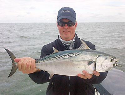
To prove what’s possible around Montauk Point these days, Edward L. Shugrue III visited it with a guide, Ken Rafferty. This false albacore was caught on his fly rod.
Ken Rafferty
This is the time of year when serious surfcasters get serious
By
Russell Drumm

   Word has come that John DeMaio, a veteran Montauk charter fisherman, died on Monday morning in Florida. He had a number of boats during his tenure as one of Montauk’s more successful chartermen. They were all named Vivienne after his wife, who survives. A complete obituary appears elsewhere in these pages.

    This is the time of year when serious surfcasters get serious, and so far Mother Nature has provided fish to get serious about. October 10, 2011, will be remembered as one of the more amazing days for a surfcaster to have been in Montauk. Huge schools of striped bass congregated around Montauk Point. All the signs are there for another bass-filled October within casting range.

    At Montauk Point during the week, schools of bass, with a few bluefish mixed in, swam within range of Turtle Cove, then past the stone revetment in front of the Lighthouse, and on to the North Bar area on either side of the top of the tide. With few birds showing, the arrival of the schools was telegraphed by rods bending in succession along the line of casters that, as usual this time of year, especially on weekends, can be shoulder-to-shoulder,  with an expletive or two thrown in for good measure. 

    Newcomers to the Point’s precarious rock ballet and crossed-lines-untangling tango can get hot under their $1,200 designer wetsuits. Best to relax, not easy when your neighbor’s bucktail takes a wrap on your line and swings like a pendulum, threatening its integrity just as you’re reeling a 20-pounder to within reach.

    And then, when you bring the fish over the rocks with the help of a rush of white water, there’s the challenge of getting it before the next wave breaks on your head, and when it does break on your head, the challenge of holding on to a freshly revived, muscular, 20-pound striped bass that has lost all sense of humor.

    On Sunday, Ken Rafferty, a light-tackle and fly-fishing guide who fishes from Montauk this time of year, visited the Point with a fly-rod-toting Edward L. Shugrue III.

    “We went out from about 1:30 to almost 7 in the evening. There were blitzes everywhere, lots of albies (false albacore), striped bass, and one bluefish. He had a grand slam,” meaning his client’s catch consisted of each of Montauk’s three favorite fall inshore fighting fish. They often show up at the same time, the bluefish attacking a balled-up school of prey, bass swimming below to catch the scraps, and the false albacore swimming circles around the prey as though to corral them before rocketing through the school for a mouthful. It’s an impressive phenomenon, one that often stops fishermen in their tracks. 

    “I’ve had anglers who have fished all over the world, but who have never been here for this. They can’t believe what they’re seeing. They can’t even cast. They just stand there with their mouths open,” Rafferty said.    

    The veteran fly guide said Mr. Shugrue, his client for the day, was an experienced fly fisherman. “He’s one of the longest casters I’ve ever seen in my life.”

    Rafferty was at the helm on Sunday and approached the Point with its phalanx of surfcasters in front of him and a healthy southeast swell behind. “The swells wouldn’t let the boats go too far in. But his casts are so long I was able to get him into some dangerous spots, he’d hook up, and I’d back us out. The first blitz must have been a city block wide. The waves were brown with bass and bait.”

    Big schools of bass continued to circle the Point on Monday. “Crazy good,” was how Harvey Bennett of the Tackle Shop in Amagansett described the fishing. On Monday he took a client out behind Gardiner’s Island aboard his Moon Pie boat.

    “We had 17 false albacore in the evening behind the island. I took a guy who had never hooked up before.” Bennett reported finding big porgies in Gardiner’s Bay and bluefish at Sammy’s Beach beside the Three Mile Harbor inlet and at Accabonac Harbor. He reported big bluefish schooling along Napeague’s ocean beaches.

    The Montauk SurfMasters tournament for striped bass is in full swing. Using a live eel, John Bruno found a 40.3-pound bass on the north side of Montauk Point on Friday to take the lead in the contest’s wetsuit division. Klever Oleas’s 26-pounder has him in first place in the wader division. In the women’s division, Cheryl Lackner and Christine Schnell sit in first and second places with 11.8- and 10.7-pound bass respectively. Dylan Lackner, fishing in the youth division, is at the top of the heap with a 13.5-pound bass.

Nature Notes: Cold-Blooded Crabs

Nature Notes: Cold-Blooded Crabs

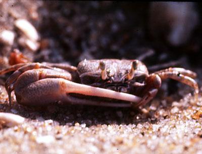
Fiddler crabs are cold-blooded. They don’t have to keep their body temperatures up, as long as they don’t let them drop below freezing.
Thomas E. Mahnken Jr.
In nature, October is a busy time
By
Larry Penny

   In less than two months it will be winter. Fall is the season for harvest and storage, in preparation for the cold months ahead. Very few of us maintain root cellars these days; we depend upon supermarkets and mom-and-pops to “store” our vittles. But in nature, October is a busy time. Those creatures that stay on to brave the sleet and snow are in full preparation.

    In my yard the non-migratory bluejays have been hiding acorns here and there for two weeks now. Gray squirrels, which also remain active all winter, are doing the same. How these cachers remember where they put things is beyond me, as I have a very hard time trying to remember where I put away much larger objects, and sometime I forget entirely. I guess if my life depended on it, I would not forget.

    Even the hibernators and semi-hibernators among the local mammals store up food. Chipmunks are notorious for putting away edibles in their hibernaculae, even providing special chambers for foodstuffs. They occasionally wake up during the long winter’s nap and want a bite to eat and don’t want to leave their cozy retreat to look for it.

    White-footed mice act similarly. They are more likely to snooze away in your house or outbuilding, or in a birdhouse or tree nest, than underground. Beavers are vegans, they keep a supply of greens in their lodges. Bats hang around for most of the winter and go hungry.

    But what about the crabs? They don’t migrate. The cold might kill them dead, especially if they freeze. Well, at least, all of our inshore crabs — the blue, the lady, the mud, the fiddler, the marsh, the spider — are in a salt water environment to begin with, and salt water is the last of the bathing liquids to freeze. Crabs are also poikilothermic, that is, cold-blooded. They don’t have to keep their body temperatures up, as long as they don’t let them drop below freezing.

    Fiddlers and marsh crabs that occupy the spartina peats and sandy edges of salt marshes retreat into their peaty holes and go to sleep. The holes in the sand are filled in and will remain that way until the warmth of spring in April wakes their dwellers up and urges them to unseal their winter quarters. At such time, a human observer will notice little mounds of pre-digested dirtballs at the entrance of each round hole.

    Marsh crabs are scarcer and larger. I’ve only seen a few in my lifetime, in the marshes at Scallop Pond in North Sea. However, in the last few years, Nicole Maher of the Nature Conservancy, who is studying the change in elevations of salt marshes here and there on Long Island in relation to rising sea level, has found quite a few of them in the marshes of Accabonac Harbor. They are secretive and not as gregarious as fiddlers and have much larger holes. They utilize the cavernous nature of the peat layer to survive and stay cool in the winter.

    Cancer crabs, the large ocean reddish ones, stay active all winter, as the bottom of the ocean never approaches freezing at this latitude. But the famous blue crab, Callinectes sapidus, which translates appropriately into beautiful-swimming-savory crab, and its cousin, the lady crab, also a swimmer, and an infamous biter of clamming toes, become dormant, digging into the sands and silty bottom sediments the way diamond-back terrapins and eels do, very often in the very same neighborhoods.

    Crab biologists in the Chesapeake Bay, which produces 50 percent of the annual blue-claw crab landings, have been pulling dredges through these sediments systematically during the winter since the early 1990s. They have discovered that it is a good method for gauging the crab population-to-be, come spring. 

    Female blue crabs, the ones with the wide “telson” on the underside of the shell, are the last to go under as they first have to attend to reproduction, some of the steps of which also resemble that in turtles. The males copulate with the females (at such time crabbers that catch them call them “doubles,” the males on top, females on the bottom), but the sperm is kept in storage until November, by which time the females have moved to saltier water, closer to the mouth of the estuary. They can store viable sperm for up to a year, in the way that many females turtles can. The fertilized eggs hatch into swimming larvae which occupy the water column. The females are free to dig under to spend the winter in a quiescent state.

    What about spider crabs? They move into deeper water and like to feed on bay scallops. Better catch those remaining male blue-claws while the crabbing’s good and they’re still above the bottom, not into it.