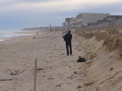
Coastal Shifts a Long-Term Threat

Adapting to climate change, enhancing fisheries, and preserving cultural and ecological resources were the focus of a report on implementing the Local Waterfront Revitalization Program that the town’s waterfront advisory committee delivered to the East Hampton Town Board on Tuesday.
The recommendations are those considered most time sensitive, Rameshwar Das and Rachel Gruzen, members of the committee, told the board, and would provide an important update to the L.W.R.P. in light of the developments since the document was completed in 1999. The developments cited were beach erosion, plans for a wastewater treatment system in downtown Montauk, and a plan for an energy storage facility between Fort Pond and Fort Pond Bay in Montauk.
“With the town’s initiatives,” such as the hamlet studies and the Coastal Assessment and Resiliency Plan, “I see all of those things need to converge in what will be a policy update of the L.W.R.P.,” Mr. Das said. “If those can all be brought to bear on an update . . . I think we’ll have much more of a utilitarian coastal management plan for the coming decades.”
Climate change, sea level rise, and increased storm activity represent the greatest threats to East Hampton and its residents, the report states. Storms and increased erosion are short-term threats, and climate change is “a slow-motion emergency that over coming decades may submerge significant portions of the town’s coast, endanger life and property, infiltrate freshwater aquifers with saltwater intrusion, and threaten the town’s economic growth as both a year-round and summer resort community,” the report states.
Hazards and hurricane damage mitigation plans are urgent, it says, “given the projected increased incidence and severity of hurricanes and other weather events.” The town should pursue grants to address breach closure contingencies, detailed poststorm recovery and reconstruction, and targeted buyouts.
Integrating sea level rise estimates is critical to planning, according to the committee, and sea level rise projections should be mapped in detail to show what areas will be inundated and in what time frame, where infrastructure will be at risk, and where water tables will be affected by saltwater intrusion. These projections should be reassessed biennially.
Planning and zoning board decisions should be based on the legal ramifications of flooding, the report says, citing approval of the substation and proposed battery storage facility in Montauk as an error. “The developments were approved despite being located in a flood zone . . . which defies responsible planning,” according to the report.
Erosion-control districts, such as those created by the Town of Southampton for beach replenishment in Sagaponack, can help manage long-term erosion and should be explored for locations including bayside subdivisions and downtown Montauk, once beach stabilization is completed there, the report states.
The encroachment or displacement of fishery infrastructure by retail, restaurant, and tourism-oriented businesses is cited, and the town should continue supporting the sustainable seafood movement, including new models for marketing and distribution of local and sustainably harvested fish, the report says.
The committee recommends that planning be continued to improve the property around Montauk Harbor. “This is a complex region given waterfront development density, commercial activity, and compromised water quality,” the report says. Maintaining docks, landing sites, and packing facilities is critical to preserving the area as a vital port with a waterfront-dependent economy and the town’s traditional cultural identity.
“It is important to maintain Montauk Harbor as an economic generator that feeds jobs . . . and provides a local fresh-fish supply to Montauk and the region’s restaurants with minimal carbon footprint from transport,” the report says. The town also should come up with best management suggestions for what it calls sustainable “aquatecture,” for commercial and residential waterfront property owners to mitigate storm damage.
The former fish factory on Cranberry Hole Road in Amagansett should be revitalized and the State Office of Parks, Recreation, and Historic Preservation should be engaged to ensure that future plans for Napeague State Park are congruent with the L.W.R.P., the committee says, while recreational activities there should be limited to passive uses such as walking and recreational fishing but the launching of motorized vessels should be discouraged.
The committee recommends an update to identify “habitats at risk and those that are already disturbed or degraded.” Nonnative plants and animals have become threats since drafting and approval of the original L.W.R.P., the report states, and native habitat acreage has diminished due to competition from invasive species and development. The report also says deer foraging has had a “significant and deleterious” effect because it eliminates understory vegetation and may be causing permanent change.
The committee recommends that the town provide additional resources for enforcement of the Peconic Estuary’s no-discharge regulation and increase the number of pump-out boats at docks and marinas to reduce pollution in bays and harbors. A boating education project would also help protect and improve water quality, the report states. Finally, the committee recommends that our coastal oral history be updated.
“A lot of this work has been implemented for decades,” Ms. Gruzen, an environmental planner and educator, said at the conclusion of the presentation. “It’s not that there’s new material here that we’re all of a sudden presenting. It’s constantly being worked on by your departments and by all of you. So thank you, and we very much enjoy serving as advisers.”
