Nature Notes: True Originals

It is impossible interpreting the present, but you can come close interpreting history. In my mind the history of East Hampton, and for that matter all of Long Island, is much more interesting than what is happening now. We’ve passed way beyond the age of discovery; we might better describe contemporary life as the age of packaging, marketing, distribution, and bad political theater. There are no Jeffersons, Washingtons, Lincolns, and Franklins to lead and enlighten us, only their poor likenesses recycled over and over to lull us into acquiescing submission.
I try to keep up, but keep up with what? I invariably find myself drifting back to the way it was when I was a child, the way it was before I was a child. In that respect, a picture is worth a thousand words.
Old photographs and old maps are my salvation. Old maps of Long Island and the South Fork keep me going. They let me climb back into a time when everyday life was a different kind of challenge than offered by reality TV. It was a time when living off the land was, indeed, living off the land. Time was slower, and except for lightning itself, things didn’t move with lightning speed. People then were not derivative, not mere models of other people; they were all individuals who worked hard with the simple tools at their disposal. They used their hands in a variety of ways, not just for typing and driving and waving in the air while they raved it up, but to knead the soil, make things, catch things, harvest things.
On my 1838 U.S. Coast Maps, for example, I can count the houses and other buildings, the cemeteries, the farms, the orchards, the bountiful woodlands, the marshes, dunes, the bays, creeks and ponds, the old dirt roads and trails. There have been lots of changes in the human landscape since that time, most of them occurring since World War II. Sadly, many of the features seen on my old maps are no more. But several are, such as on the 1838 map, Sag Harbor to Accabonac Harbor, remnants of the old bridge across Little Northwest Creek, a relic of what is now called the “Old Sag Harbor Road” which ran from Southampton to East Hampton and has been replaced by Noyac Road and Route 114.
Many of the old trustee roads have been overgrown with woods or reduced to foot trails. A few such as Six Pole Highway south of Sag Harbor, the now LIPA high-voltage power line from eastern Southampton into Wainscott, Two Rod Highway, and so on are cleared or partially cleared and still navigable.
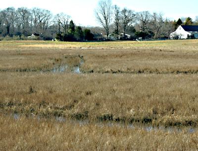
Perhaps, the most unusual of these old byways, are the corduroy roads fashioned from wooden sampling trunks laid side by side that circled the edges of marshes and gave firm footing to carts carrying marsh hay, eelgrass, and other wetland harvest products drawn by horses. In the olden days marshes provided forage for livestock, insulation for houses. Parts of one of these old roads still exist in the marshes of Accabonac Harbor.
The road remained largely intact until the 1930s when mosquito ditches were being dug through Long Island marshes by hand as part of the Great Depression’s Works Project Administration. As you walk along the ditches, say, north of Landing Lane off of Old Stone Highway, you will see where the ditchers had to cut through this marsh highway in spots to complete a ditch. The thinnish boles making up the road are covered by a layer of marsh peat and soil six or more inches thick, sediments that have been deposited over a century or more by wind and tide.
The wood is still sturdy. In the old days boat makers used to put wood for making hulls in salt marsh mud for a time to soften it for shaping. The salt marsh soils are anoxic, and very little decomposition of the wood takes place under such low-oxygen conditions. No doubt, oxcarts or other drays will never traverse these salt marsh roads again, but they serve as a reminder of a time when we all, not just a few of us, lived off the land and its riches and all human life was truly original and not derivative.
