Public To Consider Townwide Upzonings
Following through on East Hampton Town's new open space plan, the Town Board has invited the public to speak its mind on the plan's recommendations to upzone 140 parcels - some large and some small, some innocuous and some highly visible - located from Wainscott to Montauk.
The open space plan, like its predecessor, addresses the development or preservation of more than 700 lots townwide. For decades officials have sifted through the list of vacant parcels and farmland earmarked for acquisition and acted to buy or otherwise preserve them as funds and the willingness of the owners allow.
Planning Tools
Calling the recommendations "tools the town can use to be sure our planning keeps in step with the march of development," Supervisor Cathy Lester said she supported all 140 upzonings, plus two others that are covered separately.
"It's really critical that we take this next step to rezone properties that are inappropriately zoned for today's planning situation," she said.
The largest block proposed to be upzoned is owned by a pool of investors led by Imre Rosenthal, Richard Brockman and his mother, Elizabeth Brockman, and the estate of the late Jolie Hammer.
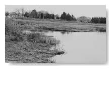
Their seven lots in north Wainscott and Northwest Woods - bordered by Sag Harbor Turnpike, Stephen Hand's Path, and Wolf's Hole Road - represent nearly 321 acres altogether.
Five-Acre House Lots
The open space plan recommends rezoning each to require at least five acres per house, and including all the lots in the water recharge district, where restrictions on clearing and construction are more stringent. One lot is now zoned for commercial-industrial use, others are two-acre residential, and all but one are already in the water recharge district.
Last year, a lawyer for the Rosenthal group spoke against adoption of the open space plan, saying the recommendations to upzone his client's land were unfair.
Lauder Land
New to the upzoning discussion is a 129-acre parcel nearby, on the Sag Harbor Turnpike just north of Goodfriend Park, owned by P.W.J. Associates. The plan recommends it be upzoned from commercial-industrial to five-acre residential.
Also in Wainscott, Ronald and Jo Carole Lauder and their daughter, Aerin, heirs to the Estee Lauder cosmetics fortune, own five lots between Beach Lane and Wainscott Pond. Their holdings come to 30 acres altogether, and some have buildings - the main Lauder house and the relocated church that caused a minor stir a few years ago - on them already.
All the lots are now zoned two-acre residential, and the open space plan calls for no change to that, but for the inclusion of those parcels in the agricultural protection district. That means any further development or subdivision would be subject to the strictest of rules.
"This is a housekeeping thing. The town wants to put all its agricultural soils in the agricultural protection district," said Lisa Liquori, the planning director.
Cagramar Farm
The same goes for the nearly 21 acres owned by Joseph and Caroline Martuscello between Springs Road and Accabonac Highway in East Hampton. They sold the development rights to 16 acres of their Cagramar Farm to the town last year and are expected to begin planting wine grapes this spring.
The owners of Cagramar, other- wise zoned one-acre residential, were instrumental in the adoption last year of a law allowing wineries to be built in East Hampton.
Jonathan T. Gardiner's 44 acres on Wolf's Hole Road in Wainscott would go from commercial-industrial to five-acre residential, and 97 acres between the west shore of Three Mile Harbor and Springy Banks Road, owned by Anthony Duke and the Harbor for Boys and Girls, would be upzoned from two to three acres per house.
The largest of Mr. Duke's four lots, nearly 69 acres, would remain in the harbor protection district.
Off Accabonac
A long list of small lots in the Northwest Woods water recharge district, each about an acre and all in the names of different owners, would go from a half-acre to one acre per house.
In Springs, a string of one-acre lots between Fireplace Road, near its intersection with Fort Pond Boulevard, and the northwest shore of Accabonac Harbor would be up zoned from half-acre to one-acre residential and added to the harbor protection district, created after the open space plan was last revised.
Just to the south, at School Street, Fireplace Road, and Old Stone Highway, a cluster of larger lots, two acres and up, would go from one to two-acre residential. Among them is more than 25 acres owned by the Springs School District and Ibram and Ernestine Lassaw's 30-acre parcel.
Offshore, a one-acre island that used to be connected to Gardiner's Island has no zoning at all. Known as the Ruins, the Federally owned island, containing an old fortification used for years for aerial target practice, would become parkland.
To Three Acres
The Devon Yacht Club's 11.7 acres between Bendigo Road and Napeague Bay in Amagansett would go from two-acre to three-acre residential, as would Francis Fleetwood's nearby 33.6 acres between Abram's Landing Road and Ocean View Lane and several smaller parcels in the Bendigo Road neighborhood.
Also going from two to three-acre residential would be 37.6 acres at the privately owned Montauk Airport, on East Lake Drive, 10 acres at the Carillo family's Flying C Ranch, nearby on Melchionna Road, and several smaller parcels on Startop Drive, some owned by the Star and Abplanalp families.
Nearly 98 acres owned by 511 Equities between Flamingo Road and Greenwich Street are zoned partly for two acres per house and partly for three acres. It would all be put in a three-acre zone and would remain entirely in the water recharge district.
The same real estate development firm owns roughly 95 acres on the north side of Montauk Point State Boulevard, next to Midland and Upland Roads. Its current zoning is likewise fractured, part in commercial-industrial, in a water recharge district, and part in a three-acre residential zone.
The open space plan calls for it all to be in a five-acre residential zone and the water recharge district.
Town Land, Too
Members of the Akin family own a combined 22 acres bordered by Flanders Road, Glenmore Avenue, Foxboro Road, and Farrington Road. Their nine lots, already in a water recharge district, would go from half-acre to one-acre residential.
The town is planning to upzone its own property as well. Thirty acres comprising the town dump in Montauk, now all in a commercial-industrial zone, would be split, the southern part to remain there and the northern part, extending into Hither Woods, to be designated parkland.
The town-owned 30-acre Fort Hill Cemetery, above Edgemere Road, is to receive the same parkland designation. It is now zoned for half-acre residential use, as is Rita Foster's nearly 18-acre horse ranch on the south side of Lake Montauk. Ms. Foster's land would be upped to a one-acre zone.
The public hearing will be held on Friday, April 4, at 10:30 a.m. in the Town Hall courtroom.