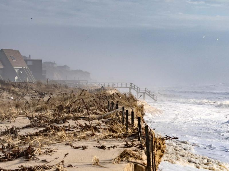
“Now is the hard moment,” East Hampton Town’s planning director told the town board on Tuesday during an assessment of a ravaged coastline after three storms in the past month.
“Now is the moment where we have to begin to behave differently,” Jeremy Samuelson told the board. “We can no longer simply continue to behave the same way and expect that everything’s going to be okay. It won’t. We have to move roads, we have to move critical infrastructure, we have to design differently, we have to move things from where they are to more sensible locations.”
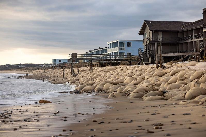
The discussion came just as mobilization for the downtown Montauk portion of the long-awaited Fire Island to Montauk Point beach renourishment project was getting underway, with 450,000 cubic yards of sand to be deposited on the downtown beach to protect the oceanfront “Motel Row” and other drivers of the town’s tourist economy.

On an unseasonably warm Friday, several bulldozers had arrived in the easternmost hamlet, four of them positioned on the ocean beach at South Eton Street. In subfreezing temperatures on Monday, that road and a portion of South Emerson Avenue were closed to traffic as trucks rolled into town to deliver 35-foot lengths of piping that would convey slurry from offshore via a nearly 500-foot-long suction hopper dredge to rebuild the beach in time for the arrival of summer visitors.
The project, anticipated to be completed in six to eight weeks depending on weather conditions, could not have come at a more opportune time: Montauk’s downtown beach is narrow, the geotextile bags installed in 2015 as a post-Hurricane Sandy stabilization measure exposed, staircases and other beachfront structures torn asunder, and, at high tide, waves lapping at the motels and spilling into the intersection of South Emerson Avenue and South Edison Street. Some roadways remained closed because of the flooding.
But the ocean beach farther east, at Ditch Plain, is in worse shape, with waves lapping at debris strewn in all directions, portions of dune ripped away by high tides, and a beach parking lot still closed to vehicles. On Monday, the Ditch Plains Association started a petition at change.org imploring the town to “embark on a comprehensive initiative for sand replenishment and dune restoration” to safeguard the future of the neighborhood. That initiative is covered separately in this issue.
In recent days, Senator Charles Schumer, Basil Seggos, the commissioner of the State Department of Environmental Conservation, and Gov. Kathy Hochul have all contacted the Army Corps to request emergency rehabilitation of Long Island shorelines, including at downtown Montauk. A press release issued by the Army Corps on Saturday acknowledged receipt of a D.E.C. letter urging an expedited review of, and emergency repairs to, four Army Corps projects “damaged from a series of recent storms on Long Island’s south shore in Suffolk County.” The Army Corps and D.E.C. will jointly perform an expedited review that will include downtown Montauk, according to the release.

“We’ve had three storms back to back, basically,” Councilwoman Cate Rogers said on Tuesday, noting multiple road closures because of ocean water inundation, including at Beach Lane in Wainscott, Gerard Drive and Louse Point in Springs, and Lazy Point in Amagansett in addition to those in Montauk. “As a coastal community, as what I consider a frontline community to the impacts of the crisis, I think it’s time for the town to develop the next phase of plans to provide the recovery.”
In what Supervisor Kathee Burke-Gonzalez had described as an informal discussion, Mr. Samuelson said that “we’re reacting rather than being proactive” with respect to storm damage to private property. He suggested that the town, with responsibility largely falling on the Planning Department, “go out and make ourselves available in advance of the need for recovery, to talk to property owners about a very simple question: What am I allowed to do if we have a loss, either a partial loss or a complete loss, on our property?”
The town code has provisions for coastal restoration projects, including repair or reconstruction of coastal structures, as well as emergency activities, but Mr. Samuelson said Planning Department officials should set aside time to be available to answer residents’ questions in advance of storm-related damage, “before we all have the collective metaphorical gun to our head and need to operate in an emergency response mode.”
The town should also coordinate shoreline surveys after a major storm, rather than individual departments conducting assessments for their own needs and not sharing information, he said.
Beyond creating and clarifying options for property owners, “we have a different set of solutions” for the medium and longer term “that, as the time is right, we will need to and want to discuss with you,” Mr. Samuelson said. In the longer term, “in many cases, that’s going to require moving up, moving back, relocating, rebuilding to what’s standard,” all concepts explored in the Coastal Assessment Resiliency Plan, which was adopted into the comprehensive plan in 2022.
The State Regional Economic Development Councils recently awarded the town a $600,000 grant to plan for the sustainable future of Montauk’s downtown. “We now need to apply that same set of questions and rationale to solutions that should be brought to bear in areas like Ditch Plain and other vulnerable areas like Napeague Meadow Road, Gerard Drive, Louse Point, Beach Lane,” Mr. Samuelson said.
Kim Shaw, director of the town’s Natural Resources Department, suggested establishing an erosion control district, a tax district to provide money for sand replenishment or other betterments in an affected area, such as Ditch Plain.
Ms. Rogers said the town must retain a coastal adaptation specialist, a geologist, to assist the town in its long-range planning for addressing climate change. There was consensus among the board to issue a request for applications for such a specialist. Ms. Burke-Gonzalez asked her colleagues to make this a priority.


