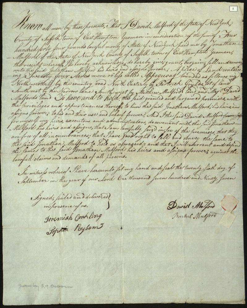
On Sept. 26, 1797, David Mulford (1754-1799) and Rachel Gardiner Mulford (1750-1811) sold 24 acres of land “in Appequoag” (Apaquogue) to his brother Jonathan Mulford (1770-1840). The parcel bordered other Mulford family properties, including land that “Major David Mulford” and his brother Matthew Mulford (1756-1845) owned. The other boundaries are described as “Narrow Lane” and Patrick Gould’s property.
Gould (1729-1800) owned land “on the Bridgehampton Road” in an area known as Jericho, which today would be near where Cove Hollow Road meets Route 27. While Rachel and David’s home at the Mulford Farm is one of the best-known family properties, the Mulfords owned land that went as far as Lily Pond Lane. The parcel’s description as in Apaquogue further suggests it was near Georgica Pond and the present-day Apaquogue Road, closer to the southwestern edge of East Hampton.
Jonathan paid his brother “four hundred and forty four pounds lawful money of the State of New York.” It may seem odd that at that point New York State residents were still using British pounds, but a wide range of international currency continued to be used in the early United States until mints were better established.
Jeremiah Conkling (1746-1824) and Sophia Rysam (1779-1858) witnessed the sale. Sophia was the youngest daughter of Capt. William Rysam (1737-1809). The Rysam family, Revolutionary War refugees, came to Sag Harbor and East Hampton from Norfolk, Va., because of the educational opportunities at Clinton Academy for Sophia and her older sisters. The Rysam girls boarded with the Mulford family, staying with David, Matthew, and Jonathan’s mother, Phebe Huntting Mulford (1736-1815). In 1795, Captain Rysam married Phebe, making her Sophia’s stepmother at the time of this deed.
Andrea Meyer is head of collection for the East Hampton Library’s Long Island Collection.


